


For Users:
For Developers and GIS specialists:

Quickly estimate the commercial real estate environment
Estimate your target audience in the environment
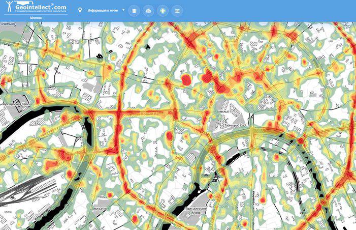
Evaluate your market potential in detail: population, residential areas, business centers and dense traffic zones
Do your competitor analysis, compare several zones
Easily get all necessary geodata for turnover prediction in a new spot
Evolve fast and qualitatively!


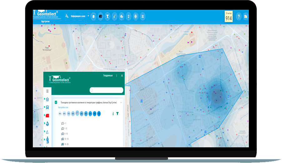
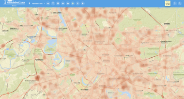
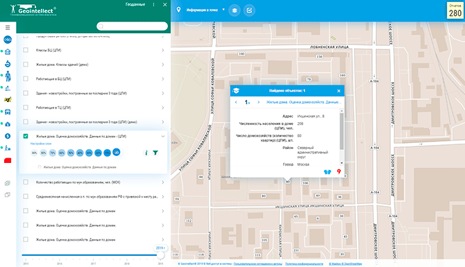
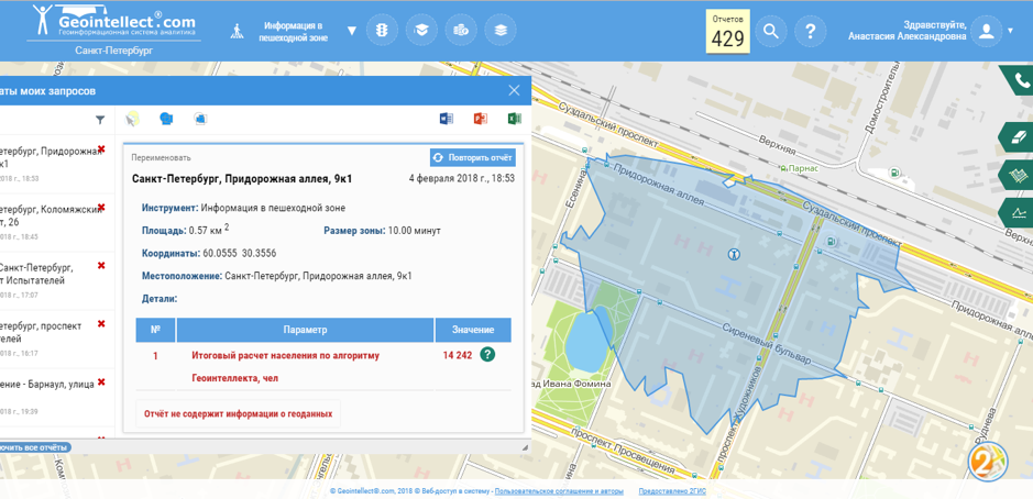
Choose a city and calculate population down to the house in a couple of seconds
Evaluate locations on population, income, traffic and competitors placement
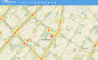
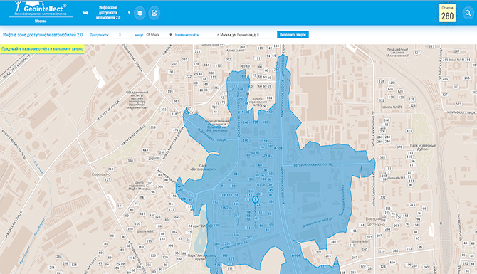
Build a zone with specified simple radius, radius with natural barriers as well as transport and pedestrian zone. Calculate parameters within them and their intersection.
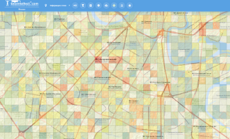
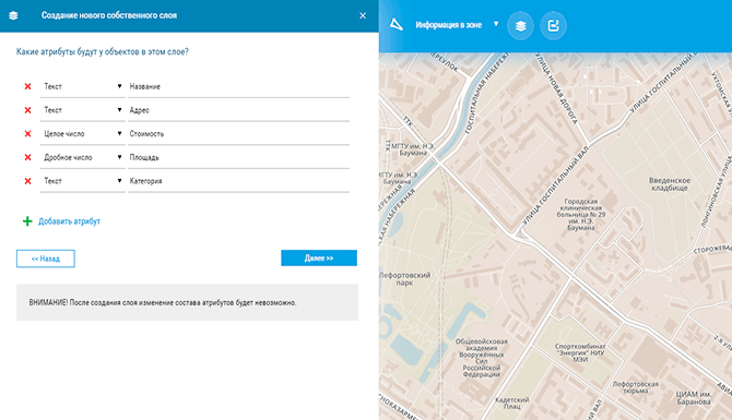
Upload your data on a map automatically or manually and analyze it along with dozens of other metrics on the Kazakhstan map.
Define your competitors, evaluate points of interest, measure the distance from them.
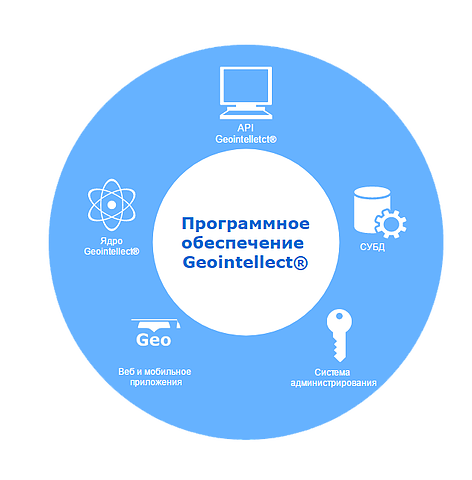
Based on the feedback from our customers we developed different map tools with wide range of functionalities.
We update data with different frequency tanks to the partner programs, geoinformation technologies, cartographers and experts in geomarketing.
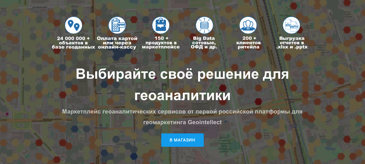
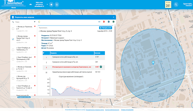
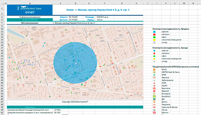
You can get reports about zones in xlsx, pptx and docx in a couple of seconds. Create a comprehensive report to choose the right location.
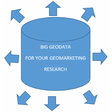
Geodata is obtained from various paid and free sources. It allows to perform research thoroughly.


2003 – The first analytical report for the network of pharmacies. Modeling of the incomes in the city.
2008 – The first major customer Walmart – geodatabases for its own geo-system. Developing geoportal for St. Petersburg government (first – b2g project)
2010 – The Idea and prototype of Geointellect Cloud, UX design, structuring geodata related to Russia, purchasing base maps for geodata. The idea of first conference “GIS in healthcare in Russia: data, analytics, solutions”.
2014 – Launching of Geointellect. Index of comfort living Urban-module. Start of partnership agreements with suppliers of private geodata in Russia. Launching of a mobile application for data collection in the “field” Geointellect.
2018 – New offers for small business were established. First integration with large companies using the API.
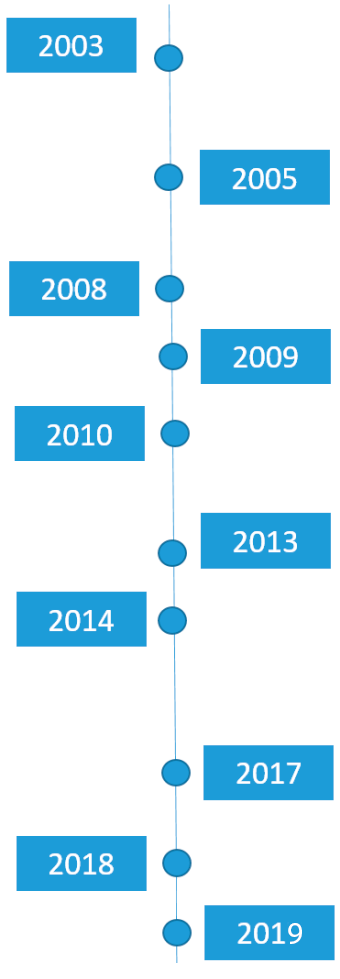
2005 – First courses on geomarketing in Russia, first customers from abroad (HomeCredit), the first major geomarketing research for the WorldClass.
2009 – Large geomarketing research for banking retail (Sberbank) in Russian cities. Active retail workshops for different segments.
2013 – Active sales of access to the cloud “Geointellect” – web applications for geoanalytics in retail. A large IT project on automating business processes for the X5 Retail Group Geographic Information System (the beginning of a 5-year project). The first results of mobile data processing (Big Data) and the first sales.
2017 – Launching of Geointellect 3.0 based on open source platform with improved usability. Released functionality of API for integration into other systems. First major performances (Yandex Conference 2017). Launching of a turnover calculator for retail – the first tool in Russia.
2019 -Beginning of partnership with MTS (telecom) under White label (geodata analysis), expansion of ‘cloud’ and Geointellect platform sales channels to b2b and b2g.


.jpg)


Mon-Fri 09:00 – 20:00
Geomarketing is a marketing research based on spatial analysis of geographic objects and environment itself. You can conduct your research right in geointelligent platform with the help of a wide range of useful tools (mapping, zoning, statistics etc.)
When geomarketing matters:
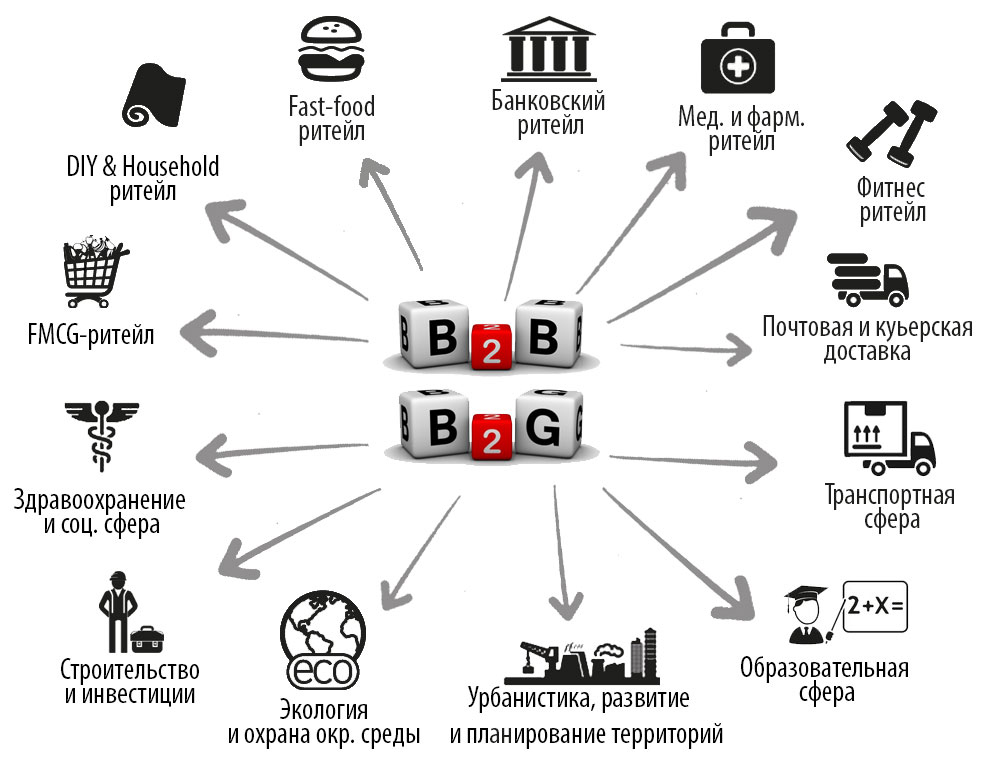
In general small, medium and large business who are to sell goods and services offline.
Why geomarketing matters:
What to analyse:
User can easily compose a report with all essential parameters and export it to xlsx, docs, pptx or perform the geomarketing research.
How to analyse:
Imagine you want to open a bakery and you have several commercial places for rent and you need to choose. In this case you can use the following roadmap
Step 1. Population
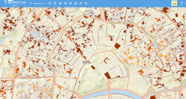
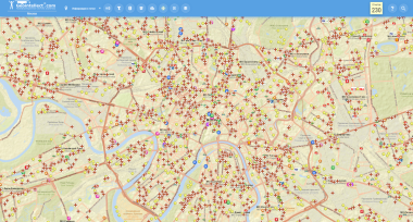
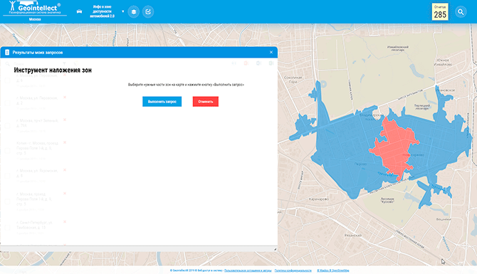
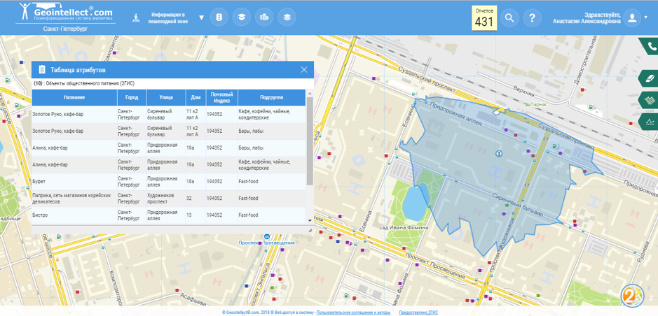
Click on a map where you consider to open a bakery. Construct the pedestrian zone (borders show you the area with 10 min walking distance, you can choose its size on your own). At first you get the number of people who live in selected area.
Step 2. Competitors
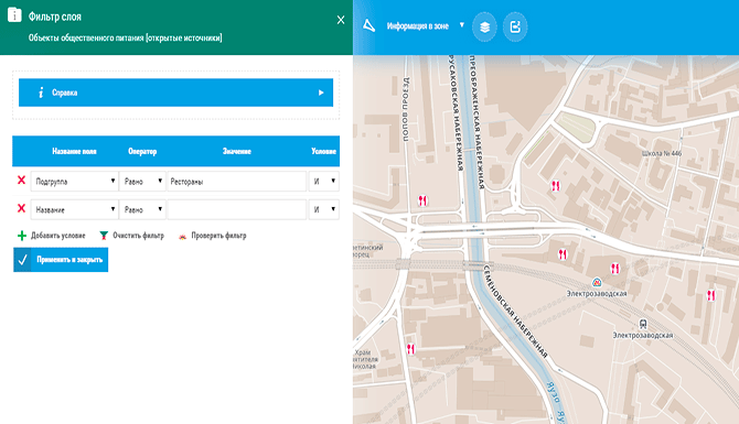
By selecting the specific layer, which is already uploaded to the system, you can identify your competitors in selected zone.
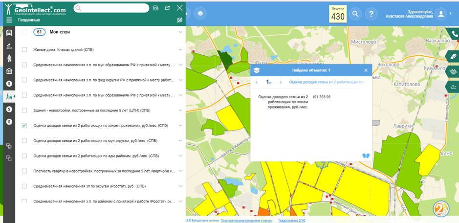
Step 3. Income level
The layer with data about the average level of income in each neighborhood can be a useful information to estimate your market capacity in this location.
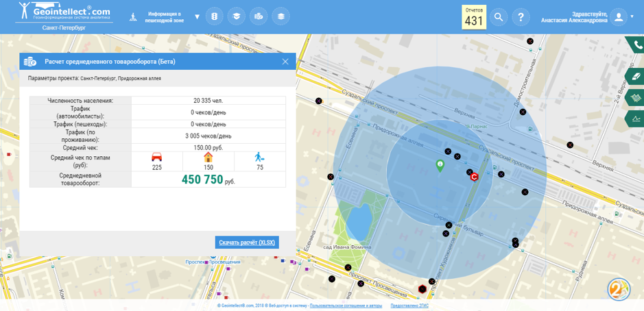
Step 4. Turnover prediction
With the help of this already integrated to the system tool you can now estimate your turnover. However the system will ask you to manually put your specific parameters such as average check and conversion rate. As a result you will get an eatimation.
This is a basic example of geomarketing research which can be done less than half an hour with the help of geomarketing platform.
How the chain of Georgian restaurants found a location for a new restaurant based on data about the environment of existing places and internal data
Problem
In early 2018 russian chain of georgian restaurants had 5 places in St. Petersburg with different revenue from 3 to 8 million roubles. The question was what were the factors that had a significant influence on such a great difference, and how to build a mathematical model which would represent the most relevant places to open new restaurants.
Solution
Geomarketing is the answer!
As long as there are only 5 observations, advanced techniques, such as machine learning, are not applicable. In this case the empiric multiparameter model of credible zones was used. This is a mathematical model based on aggregated index of location parameters which tries to identify the correlation between different factors and revenue in specified location to reveal the most relevant areas to open a new restaurant.
Step 1. Hypothesis
At first we make some assumptions about factors which have a significant influence on target variable (revenue). Globally it is about target audience distribution and competitors placement.
For example, in this case there are 4 types of visitors: who choose restaurant near their homes, near entertaining objects, near places of work and just passers-by. After defining the categories, we made calculations on these parameters: population, business center workers, pedestrian traffic, tourists flow and income level in each district. As a result we defined the most attractive areas in terms of target audience and estimated the market share of each category in total revenue.
The second considered factor is the level of competition around the city. The main competitors for georgian restaurants would be the places offering the same cuisine, the second order competitors would be restaurants with Eastern cuisine. Other restaurants as well as fast-food objects are not considered as direct competitors but still they have some contribution to level of competition. All these three categories of competitors are considered with different contributions.
Step 2. What influences revenue?
Having aggregated two global factors (target audience and competitors) into two numerical indexes: potential demand and possible market share, the descriptive analysis between geofactors and restaurant revenues can be performed. Those would be the parameters of influence.
Step 3. Result
As a result we get the final model of overall index, which includes all contributed factors as well as two aggregated indexes with respective coefficients of influence. The final model can be visualized on a map as a multiparameter model of credible zones which represents the potential areas around the city that are preferable to consider as a place for a new restaurant.

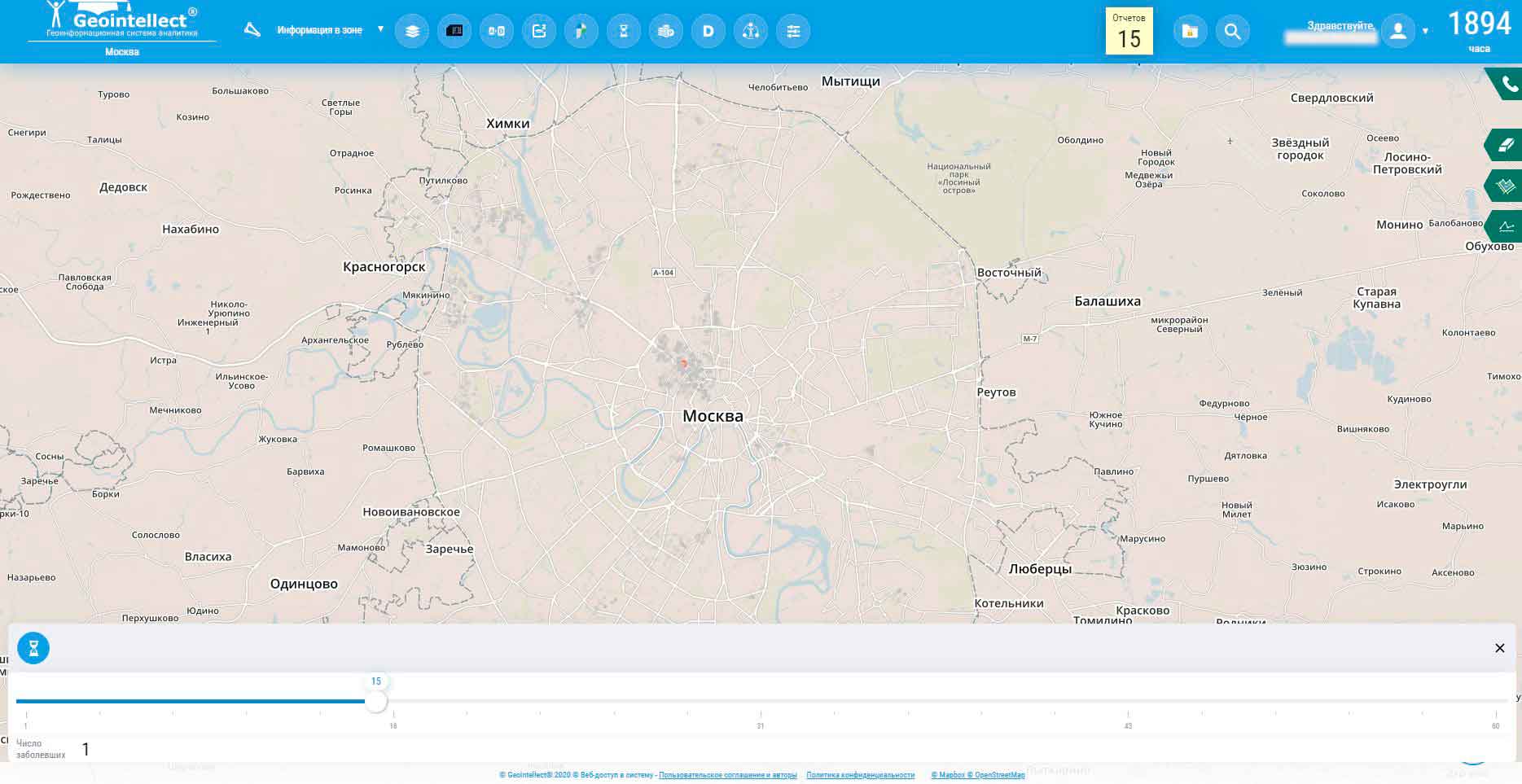
From time to time there were several epidemic outbreaks: some of them proceeded quietly, some of them – vastly and unexpectedly. As new viruses appear, epidemiologists face to new challenges and studying new cases. Most researchers visualize the official infected cases, some of them are trying to ‘model further’ the charts of distribution of disease spread and predict the number of cases around the cities and countries. But what happens if the first infected person appears in a particular city? How quickly will the disease spread, considering the characteristics of the city?
It can be predicted with the help of COVID-19 spread simulation model, which was developed by Center for Spatial Research – IT company working with GIS-analytics in retail, healthcare industry and urbanistics – in collaboration with Research Institute of epidemiology and Microbiology of N. F. Gamalei.
Data the model based on
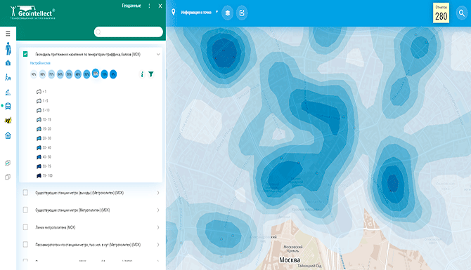
Before modelling any virus spread simulation scenario within a city, it is essential to model the basic behavior of city dwellers: where they live, how they move around the city (by foot or by public transport with transfers), where they work or study. This simulation is possible with the help of geoanalytical models of places of the highest people density (people gravitation model). Overall there are around 70 geofactors: public transport interaction features, load of stops, number of workers in business centers, number of city dwellers, amount and accessibility of grocery stores and supermarkets. It is interesting to notice that developers used the data that has been being used in their geomarketing services for location potential estimation 17 years so far.
Then it is necessary to consider the probability of being infected, including the probability of visiting places by a particular group of the population (for example, by age group). With the help of specialists of the Research Institute of Gamalei we tried to describe the virus relying on the open data from different sources. This includes the susceptibility to the virus of certain age groups, latent, prodrome periods and a number of other studied features.
Results
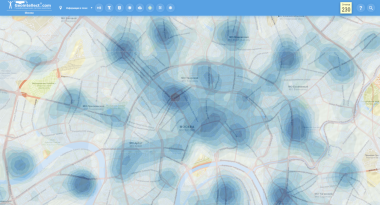
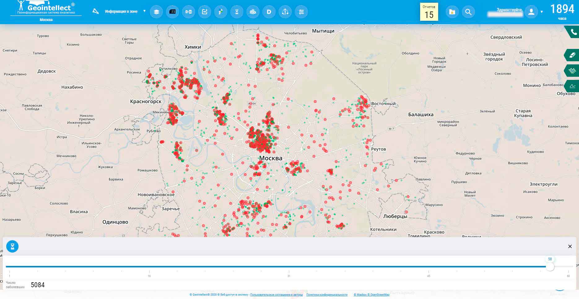
Taking into consideration the simulation model of basic behavior of city dwellers and having thoroughly described the virus, it can be possible to simulate the distribution of any disease in space and time, which can be spread through airborne contact. That describes this project made by Center for Spatial Research developers who simulated millions of interactions of Moscow dwellers of different age groups based on multi-agent system.
“Having completed the project, we deployed the model as an independent module in the Russian software “Geointellect” within Moscow. We visualized the coronavirus spread as a timeline in a separate interface of Geointellect: from the zero-patient initial moment of disease till his recovery, – said Denis Strukov, CEO of Center for Spatial Research. – Right now, the quarantine is not considered in this simulation model, it shows the scenario without quarantine measures.”
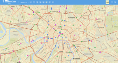
According to model prediction, if one person get infected in Moscow at a specific address X, within next 30 days 5084 new cases of infection would occur. The red parts on the map describe the sources of origin and spread of the virus. Green parts are the recovered population from the disease.
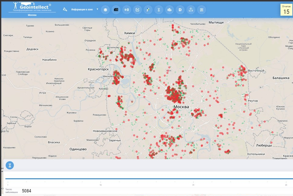
Simulated infected cases (red parts) in Moscow within first 30 days of virus spread from a distinct person at a distinct address. Green – recovered patients.
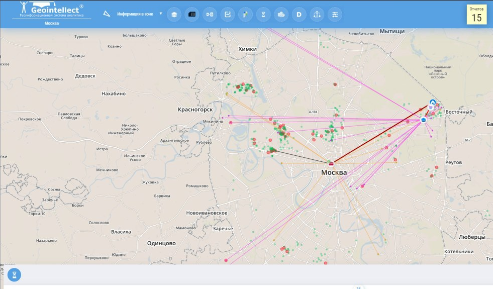
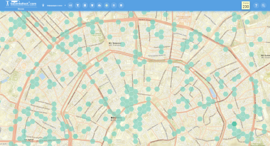
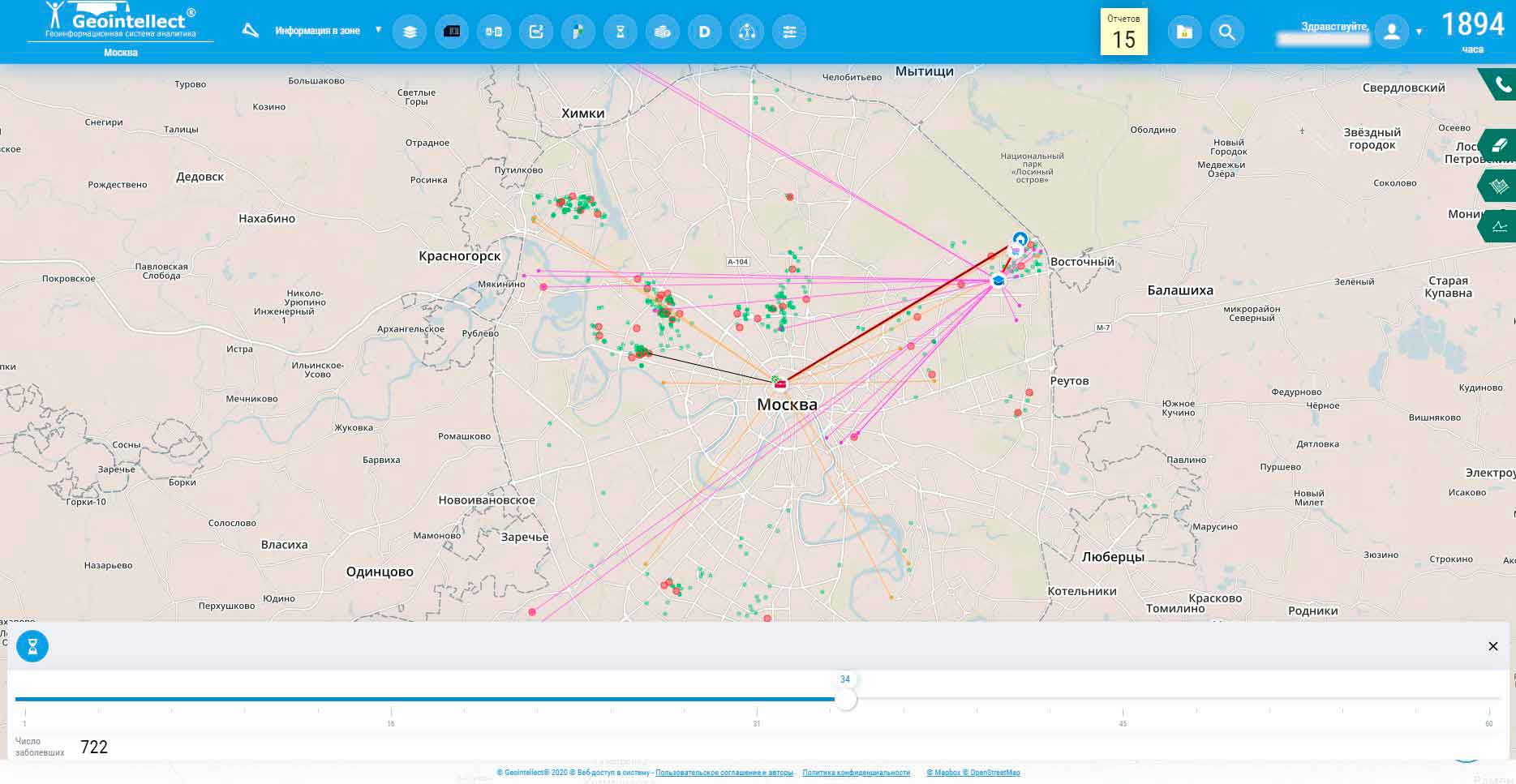
Simulation of virus spread traces from a household workplace, study place etc. By putting cursor on city object, the trace can be visualized.
The model outcome is close to the factual observation of coronavirus spread in Wuhan (Hubei province) from the initial point of disease registration. If it is considered that Wuhan and Moscow are “similar” (at least on population), then first conclusions about model performance in case of absence of quarantine measures can be made.
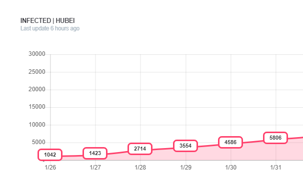
Graph shows the dynamic of coronavirus cases in Hubei (Wuhan) https://coronavirus.app/fiJ14DCxw15e3SMemh8R
It should be noticed that there are some constraints. For example, as Moscow infrastructure data and data about people gathering places are real, however people and their interaction is a simulation based on gender and age structure of different Moscow districts.
Geointellect.ru
Foreign experience:
NYT:
https://www.nytimes.com/interactive/2020/03/22/world/coronavirus-spread.html
Washington Post:
https://www.washingtonpost.com/graphics/2020/health/corona-simulation-russian/
What we offer:
The Russian government decided to monitor coronavirus carriers: https://hightech.fm/2020/03/23/covid-surveillance. Personal geodata from smartphones, which we have not used, can be useful to improve the model performance.
To sum up, we have a unique chance to:
Examples:
Example of the fist step of experiment in Moscow here:
Reportage on tv channel Izvestiya 78:
https://www.youtube.com/watch?v=5W4c0yNPUlc
News on fontanka.ru
https://www.fontanka.ru/2020/02/18/053/
Citation in vedomosti.ru
Best regards,
Denis Strukov, PhD, CEO Geointellect